Earth Observation for Monitoring and Modeling Land Use
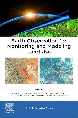
Earth Observation for Monitoring and Modeling Land Use

Triantakonstantis, Dimitris; Da Silva Fuzzo, Daniela Fernanda; Srivastava, Prashant K.; Fischer Filho, Joao Alberto; Lamine, Salim

Elsevier - Health Sciences Division

11/2024

400

Mole

Inglês

9780323951937

Pré-lançamento - envio 15 a 20 dias após a sua edição

Descrição não disponível.
Part I. EO datasets for land use/land cover 1. Remote observation for predicting soil moisture in integrated crop/livestock areas 2. Soil Chemical Properties using Hyperspectral Remote Sensing 3. Monitoring and modelling urban growth dynamics of Pune and Pimpri-Chinchwad City, Maharashtra, India 4. Drones in high resolution land use assessment using artificial intelligence Part II. Land use/land cover classification 5. Mapping the Soil Organic Carbon Sequestration Potential of Greece's Agricultural Soils 6. Mapping Greece's Salt Affected Soils Extent with the use of Machine Learning and Remote Sensing Data 7. A View of Biological Invasions at the Landscape Scale: A Case Study of Two Australian Acacia Species in Portugal 8. Land use and socioeconomic interventions in the production of urban climate: day and night thermal effects in a continental tropical city 9. Landscape Geoecology in the Feasibility of Creating Linear Parks in Urban Microbains Part III. Operational EO Tools for Monitoring and Modelling land use/land cover 10. Hyper-Spectral Remote Sensing: Potential Prospects in Water Quality Monitoring & Assessment 11. Appraisal of Spatial interpolation techniques in predicting soil organic carbon using Earth Observation datasets 12. Conservation Status of Permanent Preservation Areas and of Water in the Cabacal River Basin, Mato Grosso State, Brazil Part IV. Looking into the Future: Challenges and Perspectives 13. Modeling and predicting future land use: application of Dyna-CLUE and Markov Chain - Cellular Automata Analysis (CA-Markov) models in a Brazilian watershed 14. Interpretation of Land Use and Land Cover Changes at Different Classification Levels: The Paranapanema River Basin - Brazil Case
Este título pertence ao(s) assunto(s) indicados(s). Para ver outros títulos clique no assunto desejado.
Acacia; Artificial intelligence; Artificial neural network; Bioinvasions; CA-Markov; Carbon sequestration; Chlorophyll; Classification; Climate change; Conservation indicator; Dyna-CLUE; Dynamic index; Ecogeographical approach; Environmental planning; FAO; Forest formation; Geographical information systems; Google Earth Engine; GPS; Groundwater; Hydrographic planning unit; Hyperspectral; Hyper-spectral; Kriging; Land use change; Land use modeling; Land use scenarios; Land use; Landcover; Landscape; Linear parks; Machine learning; MapBiomas; Medium sized cities; Pasture; Physical factors; Physico-chemical; Planning; Portugal; Precision agriculture; Random forest; Remote sensing; Remotely piloted aircraft; RemoteSensing; RothC; Salt-affected soils; Satellite; Satellites; Scenarios for environmental studies; Sensors; Shannon's entropy; Social dimension; Soil moisture; Soil organic carbon; Soil; Soybeans; Spatial interpolation; Spatial resolution; Spatial-temporal analysis; Sugarcane; Support vector machine; Systemic analysis; Triangle method; UAV imagery; Urban climate; Urban growth; Vegetation indices; Vegetation; Water quality